
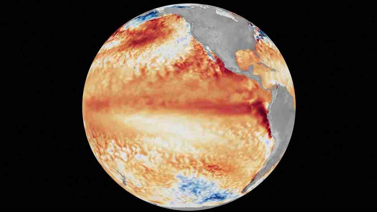
WASHINGTON, July 7 (San Diego News Online) — NOAA forecasters say El Niño conditions are present in the equatorial Pacific and are expected to strengthen through the Northern Hemisphere winter of 2026-27.
The Climate Prediction Center issued an El Niño Advisory on June 11. For readers, the practical takeaway is simple: this is a seasonal weather pattern to watch now, not a short-term storm warning. People in flood-prone or weather-sensitive areas should keep an eye on NOAA’s seasonal outlooks as the Pacific continues to warm.
What NOAA is seeing
The Climate Prediction Center, part of NOAA’s National Weather Service, said above-average sea surface temperatures developed over the past month across the central to eastern equatorial Pacific Ocean.
In its latest weekly update, NOAA said the Niño-3.4 index was +0.7 degrees Celsius, the Niño-4 index was +0.7 degrees Celsius, and the Niño-1+2 index was +2.1 degrees Celsius. Those numbers measure how much warmer or cooler the Pacific is than usual in different areas.
NOAA said its model guidance, including the North American Multi-Model Ensemble and the NCEP CFSv2 model, points to El Niño intensifying into the winter.
The agency also said there is a 63% chance of a very strong El Niño during November through January. NOAA said that could place it among the largest events in the historical record going back to 1950.
What El Niño means
El Niño is the warm phase of ENSO, short for El Niño-Southern Oscillation. ENSO is the name scientists use for the back-and-forth pattern of ocean temperatures and winds in the tropical Pacific.
When El Niño develops, the Pacific ocean near the equator warms above average. That warming can shift weather patterns far beyond the Pacific basin. It does not control the weather everywhere, but it can tilt the odds for rainfall, temperature and storm tracks in different regions.
Why forecasters care
NOAA’s advisory matters because it gives forecasters an early signal about the months ahead. Seasonal forecasts are about probabilities, not certainty. A stronger El Niño can change the likelihood of wetter or drier conditions in some places, and it can influence how often some hazards show up.
NOAA’s Ocean Service says El Niño can raise the risk of high tide flooding in some U.S. locations. That is one reason coastal and low-lying communities pay close attention to the pattern as it develops.
At the same time, an El Niño advisory does not mean every place will see the same weather. Local conditions still depend on many other factors, and the effects can vary from one season to the next.
What people should do now
For most people, the right response is to stay informed, not alarmed.
Check NOAA’s seasonal outlooks if your plans depend on winter weather, travel, agriculture, water supplies or coastal flooding risk. If you live in an area that already deals with high tides or drainage problems, it is a good time to review flood preparation steps before winter arrives.
The bottom line: NOAA says El Niño is already underway, and forecasters expect it to build further as the year goes on.
That makes the coming months important for anyone who follows seasonal weather, especially as the Pacific pattern moves toward its winter peak.
