Ancient Lake Manly Returns: Badwater Basin Salt Flats Flooded Again After Months of Unusually Heavy Storms
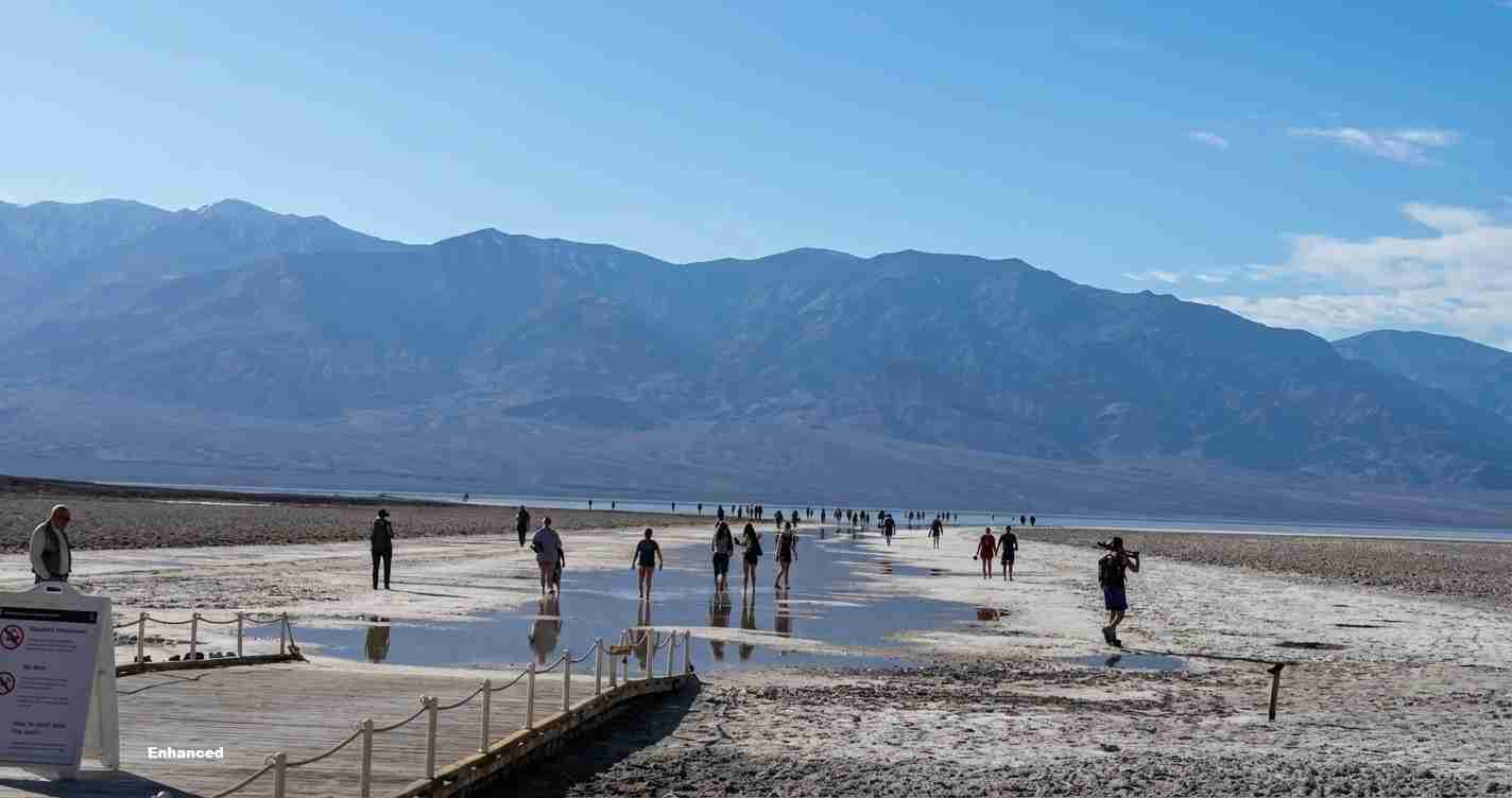
Following Hurricane Hilary’s August 20, 2023 rainfall and heavy winter storms into early 2024, a temporary version of ancient Lake Manly reappeared on Death Valley’s Badwater Basin salt flats to form a rare shallow lake before later receding.
- Rare return: A shallow, temporary Lake Manly reformed in Badwater Basin after Hurricane Hilary (Aug. 20, 2023) and additional storms through early 2024.
- Size and depth: The pond expanded to roughly 6 miles long by 3 miles wide with depths near one foot in places.
- Park management: The National Park Service restricted boating and urged visitors to stay on compacted surfaces to protect the fragile salt crust.
- Wider significance: The episode highlights how extreme weather (tropical remnants and atmospheric rivers) can briefly recreate ancient pluvial environments and affect regional water systems.
What happened
After an extraordinary pulse of rain from the remnants of Hurricane Hilary on Aug. 20, 2023 (about 2.2 inches in one day), a shallow lake returned to the Badwater Basin salt pan. Continued storms and an atmospheric river in early February 2024 (roughly 1.5 inches more) recharged the remnant and expanded the water body for weeks into spring 2024. NPS, Outside Online, and NASA Earthdata tracked the event via field reports and satellite imagery.
What is Lake Manly?
Lake Manly is the informal name for a Pleistocene pluvial lake that once filled much of Death Valley during the last Ice Age. Today the term is used for brief, shallow lakes that form on the Badwater Basin salt pan when heavy precipitation accumulates. Modern versions typically measure a few inches to about a foot deep and can persist from days to months before evaporating.
Where it forms: Badwater Basin
Badwater Basin lies roughly 282 feet (86 meters) below sea level, the lowest point in North America. Because the surface is extremely flat, a few inches of water can spread across many square miles. When flooded, the normally white salt crust becomes a dark, reflective sheet of water. The National Park Service notes that while temporary flooding happens every few years, the 2023–24 episodes were exceptional in scale and persistence.
Rainfall and reappearance after Hurricane Hilary (2023)
On Aug. 20, 2023, remnants of Hurricane Hilary brought about 2.2 inches of rain to Death Valley in a single day — more precipitation than the park typically receives in a year. That pulse revived a shallow Lake Manly, creating broad interest from visitors and scientists and marking the first substantial continuous water surface there in decades (Outside Online; NPS).
Unusually wet winter 2023–2024 and the expanded lake
After shrinking in late 2023, the remnant lake was recharged by an atmospheric river in early February 2024 (~1.5 inches), expanding the water to approximately 6 miles long and 3 miles wide, with depths near one foot in places. For as long as water persisted, visitors were even able to kayak or canoe on the shallow surface — an extremely rare opportunity at the continent’s lowest point (NPS; Outside Online).
“Traveling lake” and changing conditions
In late February and early March 2024, sustained winds of about 40 mph pushed shallow water northward roughly two miles inside the basin, producing what park staff described as a “traveling lake.” That movement spread the water thinner across a larger area, increasing evaporation and converting former launch areas into soft mud flats. When winds subsided, water sloshed back toward the original lakebed but left behind muddier, shallower pools.
“The scale of the lake was stunning,” the NPS wrote, noting how the water transformed the basin into a continuous surface.
Visitor management and park protections
Park managers acted to protect the fragile salt crust and visitor safety. The National Park Service allowed walking from the Badwater Basin parking area but urged visitors to remain on compacted surfaces. Boating was banned once mud and shallow conditions made dragging boats likely; the NPS warned that footprints and drag marks can scar the basin’s polygonal salt patterns for years, persisting until new flooding and salt recrystallization erase them.
Scientific context: climate, pluvial history and satellite observations
The reappearance is a visual reminder of Death Valley’s pluvial past. During the Pleistocene, cooler, wetter conditions filled the basin with a very large lake. Modern short-lived lakes show that the basin remains a natural “sump” that will collect water when extreme precipitation arrives. Scientists highlight the role of tropical storm remnants and atmospheric rivers in producing these revivals. NASA Earthdata and other agencies documented lake evolution using satellite imagery.
Why this matters beyond the basin
Though the flooded salt pan is local to Death Valley, the storm systems that created it affected large parts of California. Atmospheric rivers that drenched the Mojave and Great Basin in winter 2023–24 also delivered rain and snow to the Central Valley and Sierra Nevada, influencing water supply, agriculture and flood management. The episodes illustrate how extreme precipitation can reshape even the driest landscapes.
Implications for Fresno, California
Economic: Fresno, in California’s agricultural heartland, benefits when atmospheric rivers boost Sierra Nevada snowpack and reservoir inflows that support farms and urban water supplies. These storms can help recharge groundwater and temporarily reduce irrigation demand, though one event doesn’t end multi-year drought.
Political: Highly visible events like Lake Manly’s return can intensify calls for flood control, groundwater recharge projects, and resilient water infrastructure in Fresno and surrounding agencies.
Social and practical: Heavy storms bring both relief (soil moisture, replenished urban green space) and risks (localized flooding, road closures, impacts to low-lying farmland). Practical steps for Fresno include:
- Farmers maintaining close contact with water districts and forecasts to adjust irrigation.
- Local agencies reviewing flood channels, levees and drainage before storms.
- Residents keeping emergency plans current and watching for flash-flood risk.
Sources and further reading
– National Park Service: Water levels are lower in Lake Manly
– Outside Online: Ancient Lake Manly reappears after record rainfall
– NASA Earthdata Worldview archive: Ancient Death Valley lake reappears